

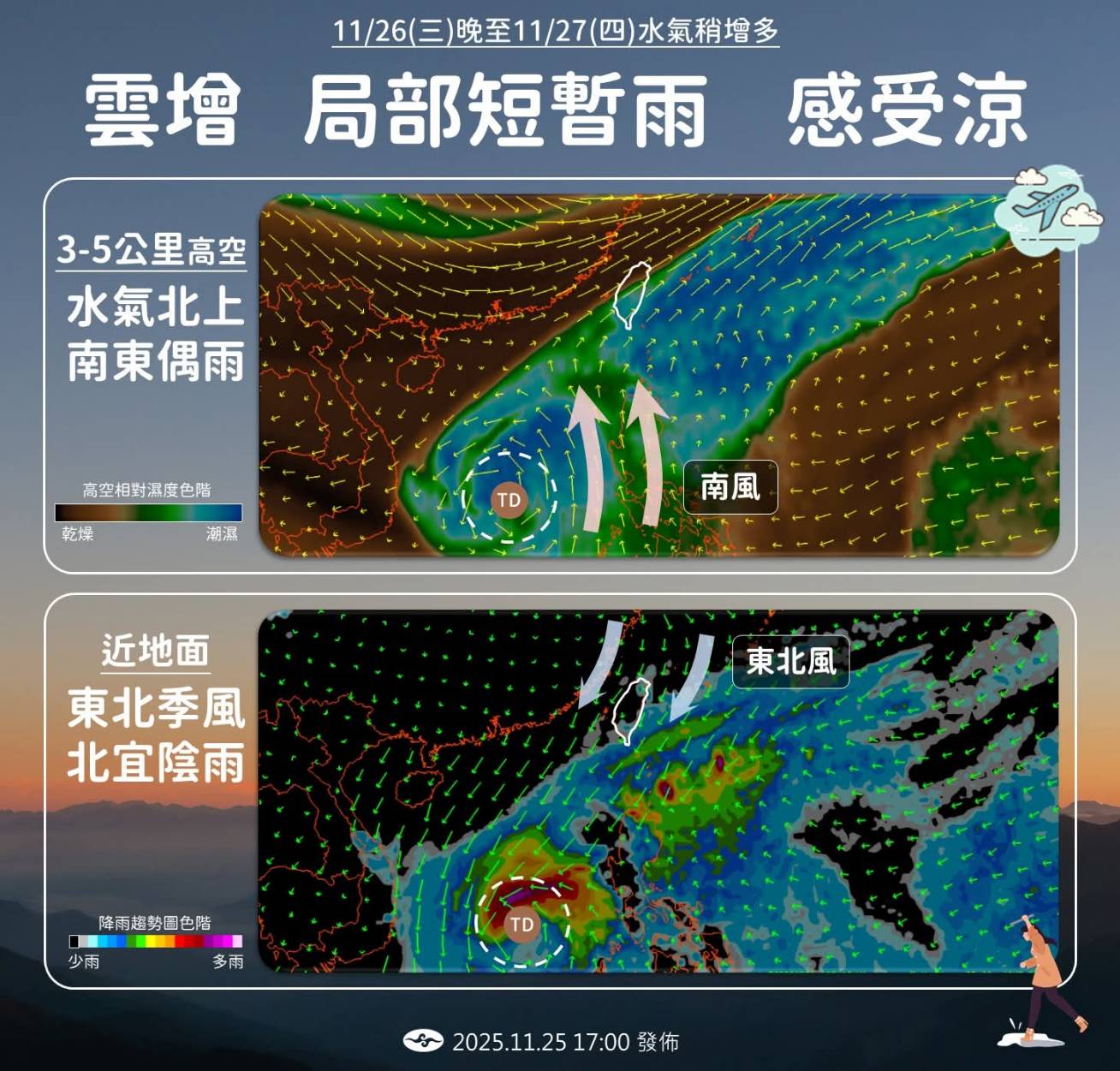
(FWA 2025/11/26)According to the Central Weather Administration, the tropical depression (TD-30) located in the Philippines has intensified into Tropical Storm Koto forms, but it will not directly affect Taiwan. However, its peripheral moisture will be carried towards Taiwan. Combined with the strengthening Northeast Monsoon on Wednesday night, rain probability increases in windward areas with scattered showers.
Wednesday (11/27) will see stable weather, but with large diurnal temperature differences. Highs in central and southern Taiwan may reach 26-27 degrees Celsius, while northern and eastern regions will see more clouds with highs around 22-24 degrees, feeling cooler. Although Tropical Storm Koto forms and moves west into the South China Sea, posing no direct threat, high-altitude southerly winds will bring moisture. Consequently, rain probability increases from Wednesday night through Thursday (11/27). Southern, Hualien-Taitung, and central mountainous areas may experience occasional rain. As the clouds are mid-to-high level, the rain will not be too heavy. Northern Taiwan and Yilan will remain affected by the Northeast Monsoon, resulting in gloomy and rainy weather, with cooler temperatures on Thursday night due to cloud cover.
Moisture will gradually decrease after Friday, and the weather across Taiwan will clear up and stabilize. However, significant temperature differences between day and night will persist, so please stay mindful of temperature changes. The Weather Administration also reminds the public that the Northeast Monsoon is strong; please prioritize safety when visiting seaside areas, as the wind chill effect will be noticeable.


