

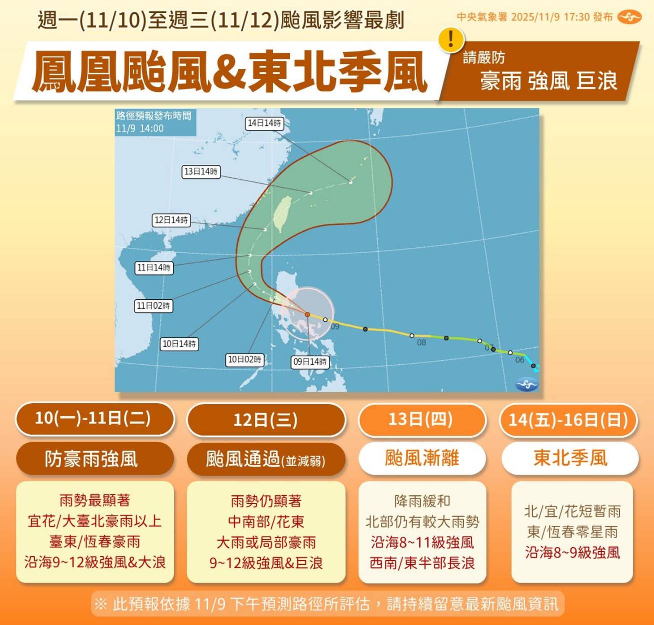
(FWA 2025/11/10)The Central Weather Administration (CWA) posted on Facebook on Nov. 9 explaining the wind and rain impact of Typhoon Fung-wong based on the latest forecast path. The most significant impact is expected from Monday (11/10) to Wednesday (11/12). A Sea Typhoon Warning may be issued on Monday afternoon, with a Land Typhoon Warning possible on Tuesday. The public is warned to take strict precautions against torrential rain, strong winds, and large waves.
The CWA stated that from Monday to Tuesday, as the typhoon moves north and approaches the seas southwest of Taiwan, combined with the Northeast Monsoon, rainfall will be most significant. The Keelung North Coast, Greater Taipei, the eastern half of Taiwan, and the Hengchun Peninsula will see showers, with other areas also experiencing local brief showers.
The Keelung North Coast, Greater Taipei, and the eastern half will experience heavy or torrential rain, especially in Yilan, Hualien, and the Greater Taipei area, with localized rain exceeding the torrential rain level. Coastal areas will experience 9-12 level strong winds and large waves.
The typhoon is expected to pass Taiwan on Wednesday as a light typhoon. The central, southern, eastern, and southeastern regions will have showers, while northern and northeastern regions will have brief showers. There is a chance of heavy or torrential rain in the central, southern, eastern, and southeastern regions. Coastal areas will see 9-12 level strong winds and large waves.
On Thursday (11/13), the typhoon will move away or weaken, but the Northeast Monsoon will still have an impact. Rainfall will ease, though the northern region still has a chance of localized heavy rain.
The CWA reminds the public to check their environment, and secure or put away items that are hanging or easily fall; avoid mountain activities due to strong winds and continuous rain; and avoid seaside activities due to large waves and strong coastal gusts.


