

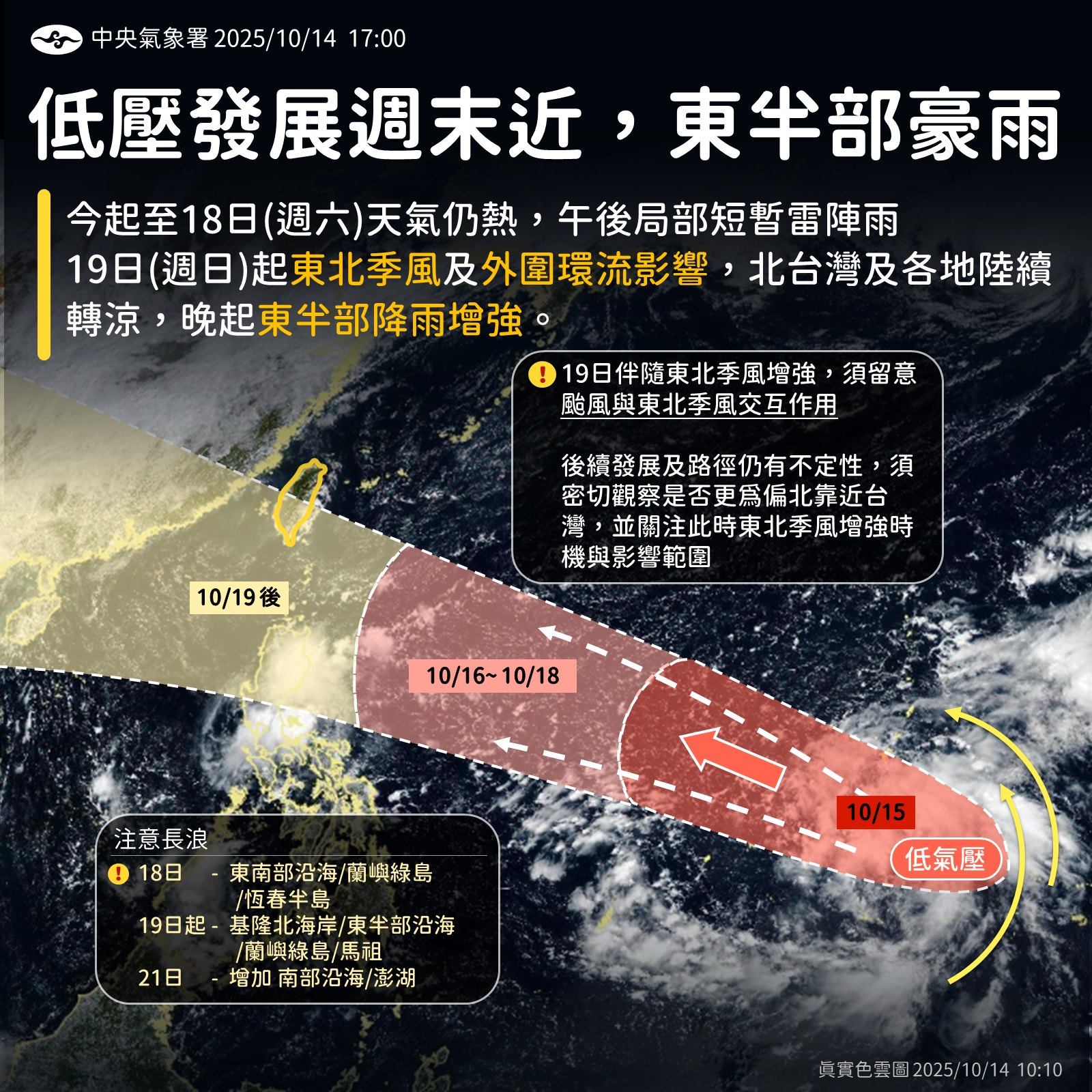
(FWA 2025/10/14)The Central Weather Administration stated that the weather will remain hot from today until Saturday (18th), with localized brief afternoon thundershowers. However, starting from Sunday (19th), due to the influence of the northeast monsoon and the peripheral circulation of a developing system, northern Taiwan and other regions will gradually cool down, with rainfall increasing in the eastern half of the island from the evening.
The CWA pointed out that the low-pressure system near Guam is continuing to organize and develop. It is expected to strengthen further, with the current projected path most likely heading west, passing over or near the waters north of Luzon Island in the Philippines before entering the South China Sea. The system has a chance to intensify into a tropical depression by Friday and could develop into a typhoon over the weekend.
The most significant impact of its outer circulation on Taiwan is expected from the 19th to the 21st. Additionally, a northeast monsoon will strengthen starting Sunday (19th), bringing slightly cooler temperatures to the northern and northeastern regions. By the 20th, a drop in high temperatures will be felt across all areas.
As the outer circulation approaches, combined with the effect of the northeast monsoon, the Keelung North Coast, the eastern half of Taiwan, the Hengchun Peninsula, and the mountainous areas of Greater Taipei will experience a significant wave of rainfall starting Sunday, which is initially forecast to reach the level of heavy rain or torrential rain.
The development of the tropical depression will be the key factor influencing Taiwan’s weather from the weekend through next Wednesday. The CWA will continue to monitor its progress closely.


